Virtual tours of businesses

Street View for internal virtual tours? What else?

The best way to showcase our business? Take a tour inside! And when this is not physically possible, Street View technology comes to our aid! Whatever your business, a hotel or restaurant, or you make handcrafted objects, a virtual tour will make your business open 24 hours a day.

Virtual tour for tourism oriented businesses

White Sands Villas & Spa - Zanzibar (TZ)

Lorem ipsum dolor sit amet, consectetur adipiscing elit. Ut elit tellus, luctus nec ullamcorper mattis, pulvinar dapibus leo.

Hotel delle Alpi - Passo del Tonale (IT)

Lorem ipsum dolor sit amet, consectetur adipiscing elit. Ut elit tellus, luctus nec ullamcorper mattis, pulvinar dapibus leo.

Salumeria 104 - Midtown Miami (USA)

Lorem ipsum dolor sit amet, consectetur adipiscing elit. Ut elit tellus, luctus nec ullamcorper mattis, pulvinar dapibus leo.

Virtual tour for businesses

Excelsa - Livorno (IT)

Lorem ipsum dolor sit amet, consectetur adipiscing elit. Ut elit tellus, luctus nec ullamcorper mattis, pulvinar dapibus leo.

Little Kook- Athens (GR)

Lorem ipsum dolor sit amet, consectetur adipiscing elit. Ut elit tellus, luctus nec ullamcorper mattis, pulvinar dapibus leo.

Cantina "Petra" - Suvereto (IT)

Lorem ipsum dolor sit amet, consectetur adipiscing elit. Ut elit tellus, luctus nec ullamcorper mattis, pulvinar dapibus leo.

Virtual tour for museums and historical places

Tomb of Lihyan son of Kuza - Al Ula (KSA)

Lorem ipsum dolor sit amet, consectetur adipiscing elit. Ut elit tellus, luctus nec ullamcorper mattis, pulvinar dapibus leo.

Church of Saint Stephan - Carisolo (IT)

Lorem ipsum dolor sit amet, consectetur adipiscing elit. Ut elit tellus, luctus nec ullamcorper mattis, pulvinar dapibus leo.

Butrint Archaeological Site - Butrint (AL)

Lorem ipsum dolor sit amet, consectetur adipiscing elit. Ut elit tellus, luctus nec ullamcorper mattis, pulvinar dapibus leo.

Questions?

The service consists in identifying cycle paths, missing or partially present on Google Maps, which will then be added, allowing them to be navigated through the famous Google application.
After that the Street View of the entire cycling network will be created, in order to have the possibility to see the route and / or to promote it.

To any destination, tourist or not, that has cycle paths and that wants to make their navigation simple and safe for a non-expert public.

The user who relies on Google Maps is generally the occasional cyclist or in any case inexperienced, such as, for example, people on vacation or who are approaching the world of biking for the first time.

Absolutely not! The service is scaled and even just some areas can be mapped, or it is possible to carry out an intervention in stages, even in different periods.

In some cases we also offer free mapping of a test route, before creating a complete project.

The service has a variable cost depending on the total distance agreed, it is in any case on consumption and only the actual kilometers mapped at the end of the operational phase are billed.

At the end of the work, all the paths object of the intervention will be uploaded to Google Maps, as well as the Street View, and the correct presence will be subsequently verified.
The updated GPX / KML tracks and a series of 360 ° panoramic images will also be delivered for the promotion of the service.
If the agreement provides for the creation of photos and videos, the original files will obviously also be delivered.

The mapping can be used directly from Google Maps, for the creation of an almost infinite number of itinerary proposals, or the itineraries can be inserted in a dedicated website, correlated by further information, photos and links to in-depth information.

An excellent example of implementation of the service is that of the Island of Elba, in the “Projects” section

Working Process

How It Works

Discussions About Project

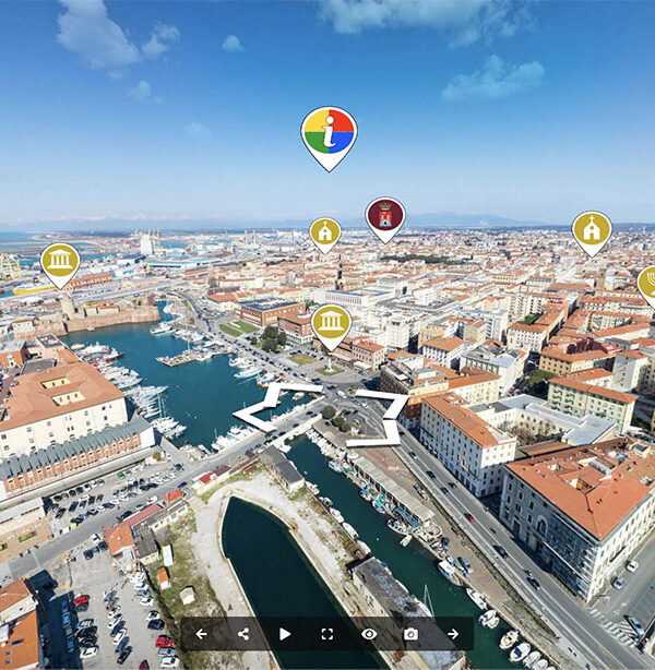
Identification and creation of paths at Google Maps level, often using pre-existing GIS paths, or creating them from scratch if not present.

Capture on field

Realization of the Street View, physically covering the paths with our special Street View ready certified equipment.

Verification & Handover

Verification of the matching of the path with the visual part, of the correct positioning, and of the correct nomenclature.

Add Your Heading Text Here

Satellite, roads and footprints update

Satellite, roads and footprints update

Global virtual tours of large areas

Global virtual tours of large areas

Cycling and hiking trails mapping projects

Cycling and hiking trails mapping projects

Street View of missing places

Street View of missing places