


Camping Mediterraneo a brand new image
Camping Mediterraneo, in the beautiful location of Cavallino Treporti, in the Veneto Region, is one of the biggest camping in the area, with several kinds of accommodation options, and services, but before our intervention, the web image and especially the one on Google Maps did not reflect reality at all.
We have therefore planned a series of actions which, through different steps, have reshaped the image of the campsite, but above all have made navigation within the campsite easy and fast, let’s see how by analyzing the different actions taken!
Satellite image renewal
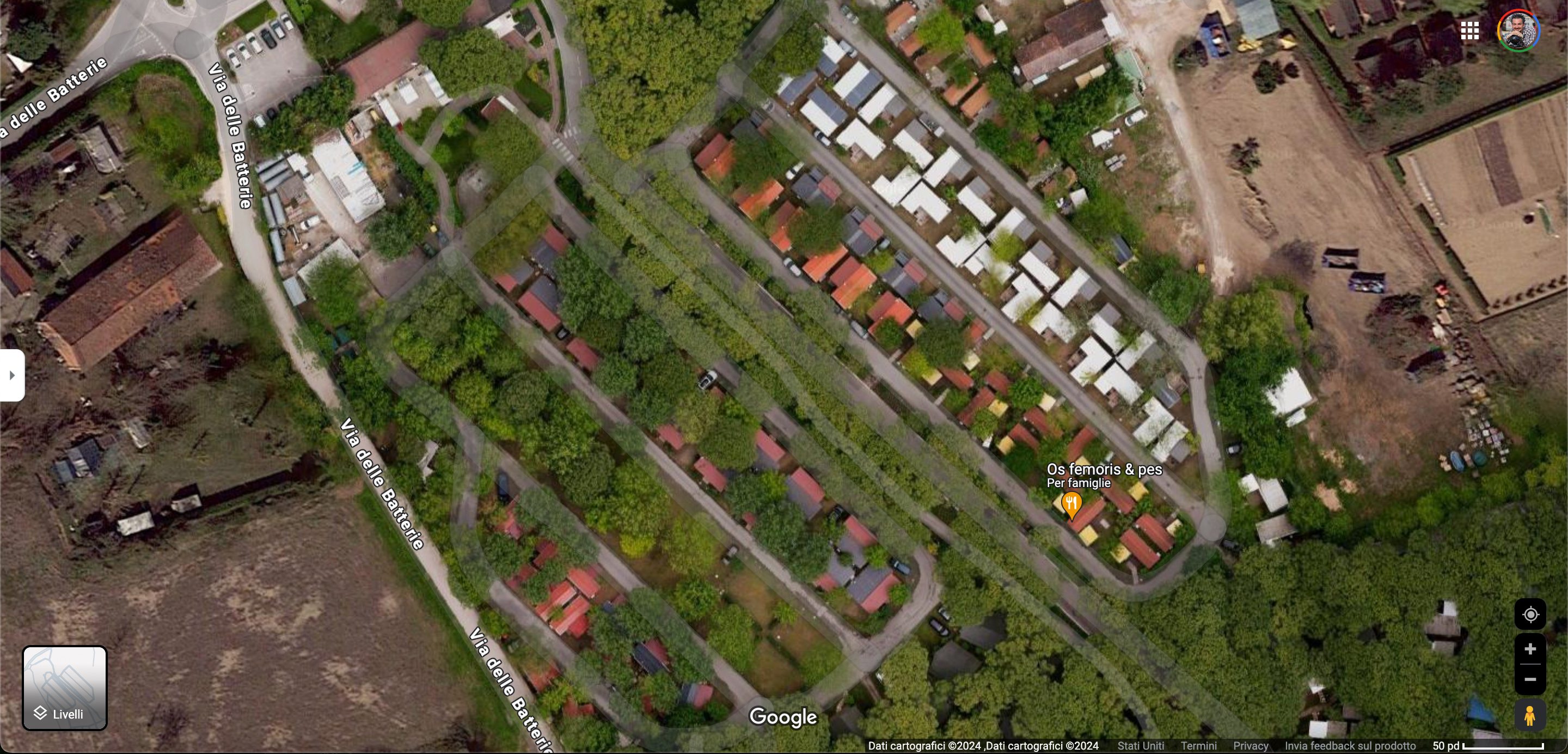
The first thing we noticed was that the satellite image on Google Maps was not updated, and therefore first of all it had missing areas, the swimming pool part did not reflect the modern water park which is instead one of the flagships of the structure, and above all the quality was very low. (check it out)
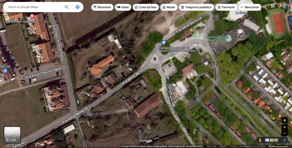
The difference between the renovated part on the right and the surroundings with the previous quality is quite clear!
Building footprints
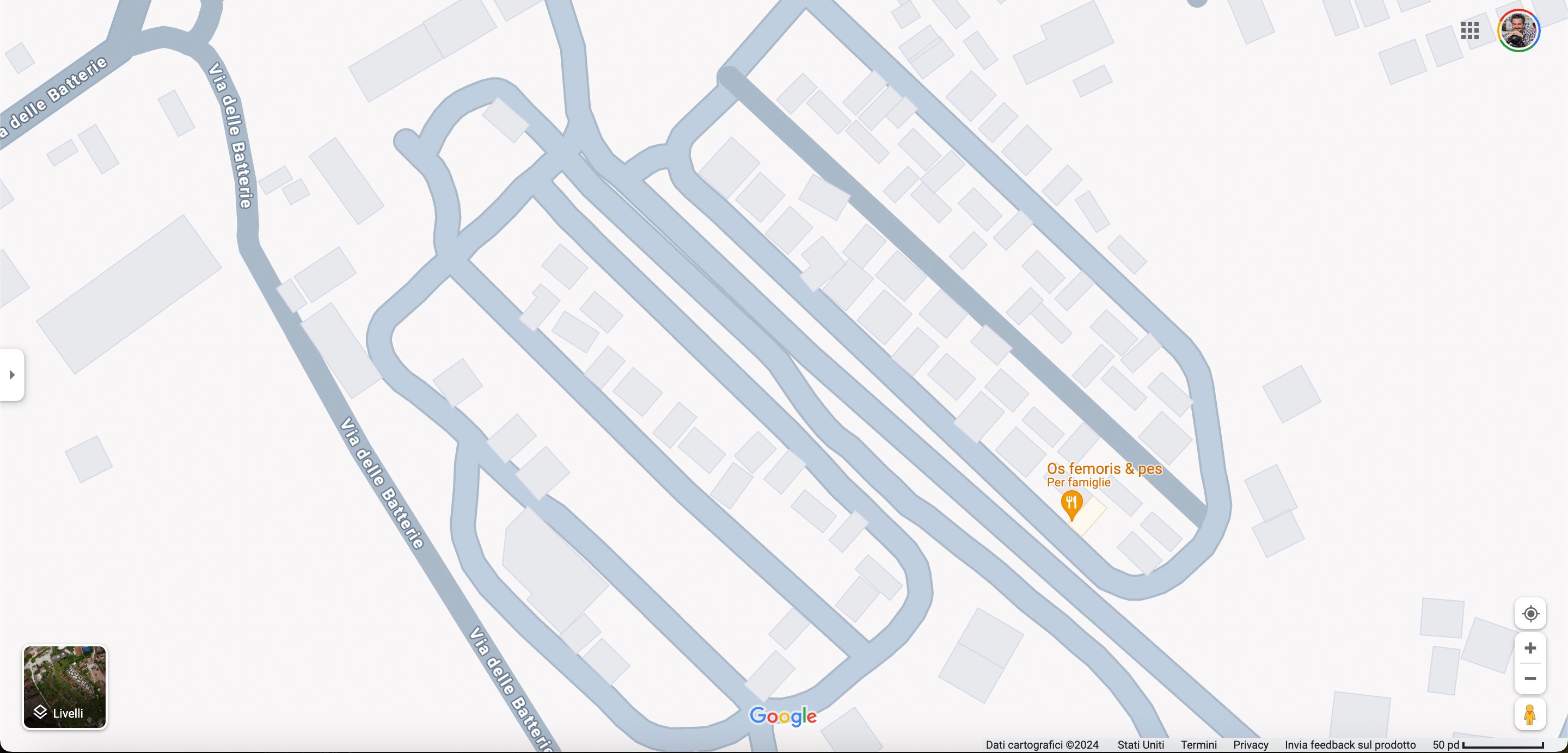
Once we obtained an updated, clear and high-resolution satellite image, we could correct, update, or remove the footprints of the buildings present in the entire area.
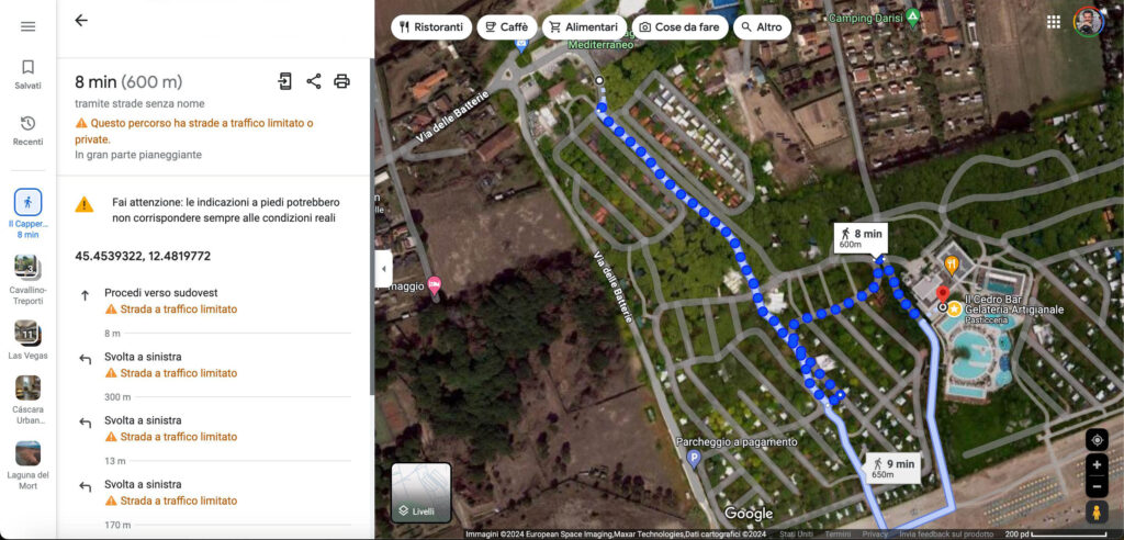
This also allowed us to add, reposition and correct the internal routes to the campsite, obtaining another incredible effect: navigability!
Internal Navigation
With the correct roads and footprints every tent, house and bungalow is in the proper place, so Google Maps can drive precisely the customers, overall the one just arrived at the campsite, to their proper accommodation, and from there to the camp amenities, with just a phone using Google Maps indications, something that almost everyone can do easily. (check it out)
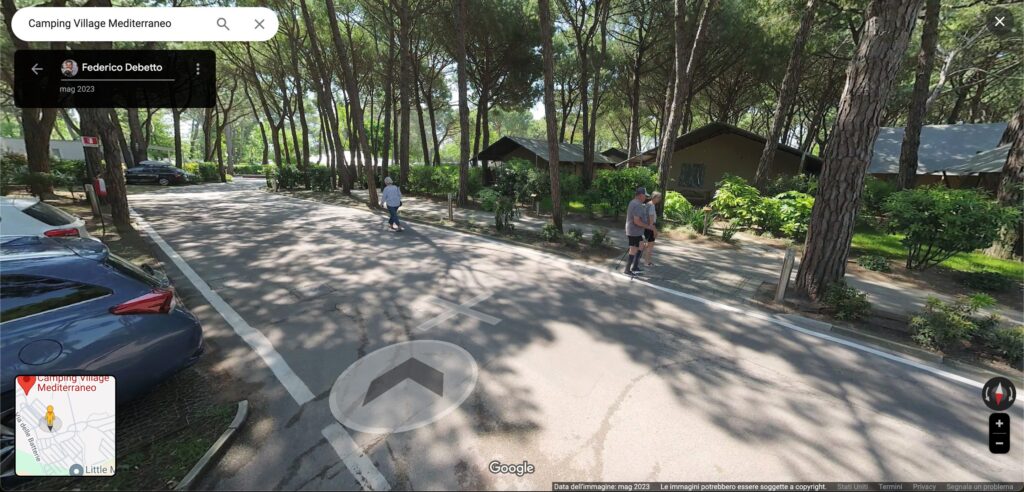
Street View
The next step to do… the internal Street View of the roads!
The internal Street View is not only an incredible utility tool for easily finding your destination, but above all an incredible promotional tool that allows you to show the structure best and gives people the opportunity to “walk” virtually even while sitting comfortably at home! (check it out)
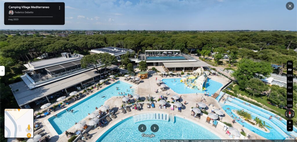
Virtual Tour Google Maps
The strong point of each campsite is undoubtedly the different types of accommodation and the virtual tour based on Google’s Street View technology is undoubtedly the best method to show both the types of accommodation and the services that the campsite can offer.
We have internally mapped the 12 types of accommodation, from bungalows to super luxury tents for glamping, obviously including all services and accompanying everything with a series of aerial photos from a drone.
The result is a virtual tour made up of almost 300 overviews and loaded directly into the campsite’s Google Maps tab. (check it out)
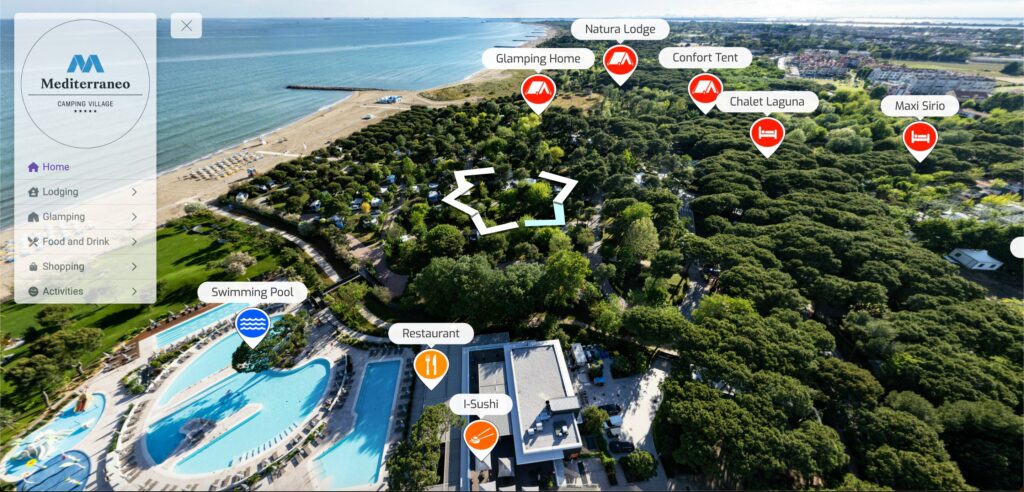
Virtual Tour enhanced
The last step in this process of total renewal of the online image of Camping Mediterraneo was the creation of an “enhanced” version of the tour where, by adding a menu and visual links via icons, we improved navigation by enclosing all the information in a single container, visual, immersive, usable from both mobile and desktop! (check it out)
By following these steps, and using the best technologies on the market, such as the 11K camera. for capturing street Street View, either on foot or through an electric caddy or by using the latest generation digital SLRs and high-precision drones, we have revolutionized the immersive, online image of Camping Mediterraneo.